Figure 3.
Download original image
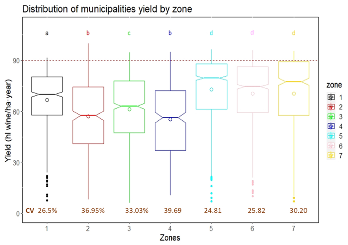
Distributions of average municipality grapevine yields (n= 606) in hl·ha-1·year-1 in each of the seven clustered zones in Languedoc-Roussillon between 2010 and 2018. The boxplots represent the distribution in quartiles with median lines. Circles represent the mean and filled dots are outliers. Letters correspond to Tukey’s range test for comparison of means. The dashed red line corresponds to the 90 hl·ha-1·year-1 maximum label yield used for yield gap calculation. The percentage in brown corresponds to the coefficient of variation over time for each zone.
Current usage metrics show cumulative count of Article Views (full-text article views including HTML views, PDF and ePub downloads, according to the available data) and Abstracts Views on Vision4Press platform.
Data correspond to usage on the plateform after 2015. The current usage metrics is available 48-96 hours after online publication and is updated daily on week days.
Initial download of the metrics may take a while.